Modeling Pastoral Mobility

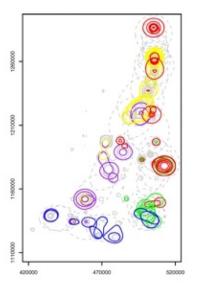
We use a combination of spatial and ethnographic analyses to study and model pastoral mobility at different spatiotemporal scales, ranging from the annual transhumance to daily grazing movements. We are also using semi-structured interviews and GPS technology to map what I call “the invisible infrastructure” of mobile pastoralists, e.g., transhumance corridors, campsites, watering places. However, mapping mobile pastoralists is complicated and requires an integration of ethnographic and spatial analysis. We are currently in the process of modeling pastoral mobility using population level data using a range of analytical approaches. We have written a number of papers that explore the complexities of using GPS to map mobile pastoralists and the challenges of mapping and protecting pastoral infrastructures, like watering places, campsites, and transhumance corridors.
Publications
Mark Moritz, Larissa Bebisse, Albert K. Drent, Saïdou Kari, Arabi Mouhaman, Paul Scholte (2013). Rangeland Governance in an Open System: Protecting Transhumance Corridors in the Far North Province of Cameroon. Pastoralism: Research, Policy and Practice. 3(26) DOI: 10.1186/10.1186/2041-7136-3-26.
Moritz, Mark, Eric Soma, Paul Scholte, Ningchuan Xiao, Todd Juran, Leah Taylor, and Saïdou Kari. (2010). An Integrated Approach to Modeling Grazing Pressure in Pastoral Systems: The Case of the Logone Floodplain (Cameroon). Human Ecology 38(6):775-789. PDF
